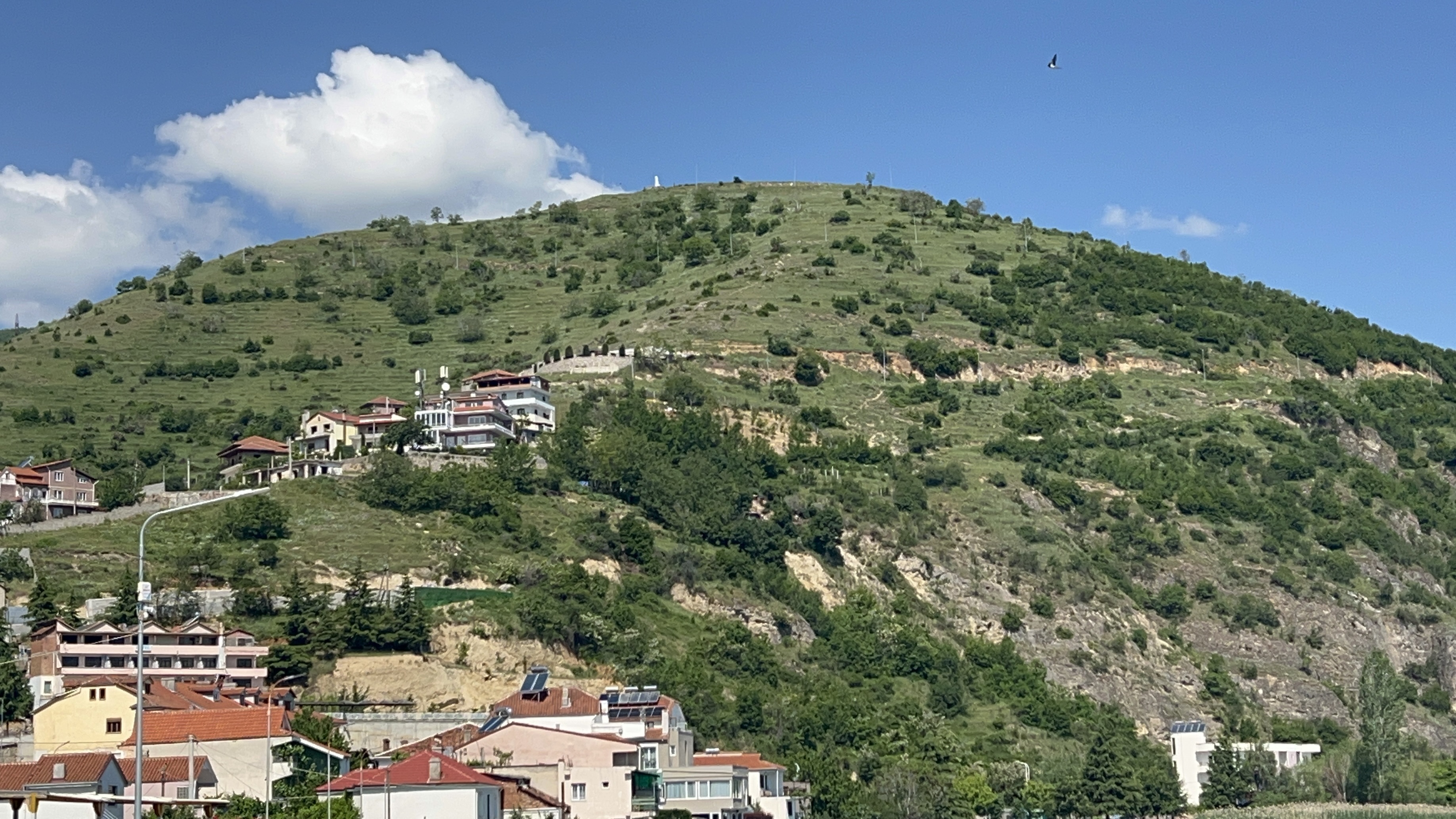
The hike up to the Castle of Pogradec is a challenging one on a hot day thanks to the incline, but it is a decently safe walk that rewards you with some of the best views in the whole area. You start out on paved streets and then spend roughly the second half of the climb on a dirt road that carries you all the way to the top.
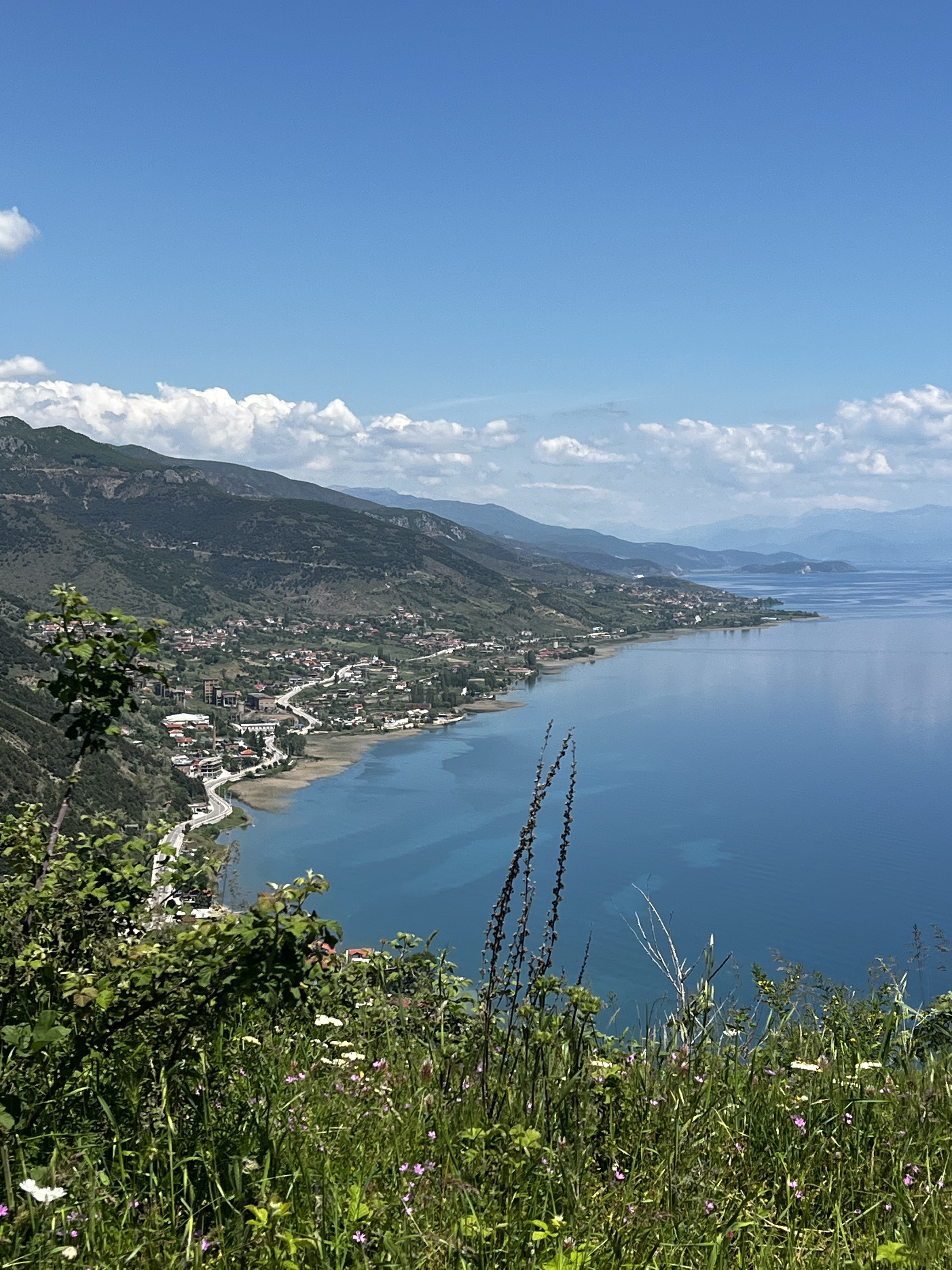
From up there you get a panorama of Pogradec, Lake Ohrid and the surrounding mountains and villages. On a clear day you can pick out Lin, Udenisht, Memëlisht and Tushemisht around the Albanian shore, and even the towns across the water in North Macedonia, including the city of Ohrid itself.
The hike at a glance
Distance and timing will vary depending on where in town you begin and how long you linger at the top. The castle sits about 205 metres above the level of Lake Ohrid.
What to expect on the climb
The first half of the route runs on the paved streets of Pogradec as you work your way up out of town and into the hillside neighborhoods. The grade is steady rather than brutal, but on a hot, sunny day the steady incline is what makes this hike feel like work, so an early start and plenty of water go a long way.
About halfway up, the pavement gives way to a dirt road that climbs the rest of the way to the castle. It is straightforward walking with no scrambling or exposure, which is what makes this such a rewarding outing: a real climb and a real view, without any technical difficulty. It is the kind of hike most reasonably fit visitors can manage at their own pace.
Finding the trail
There is a single sign on the edge of town that points you toward the start of the trail. From that point on, though, you are on your own: the route up is not marked, so it helps to know the way before you set off.
To reach that point from the centre of Pogradec, follow Kajo Karafili or Dëshmorët e Pojskës to the north-west, to the spot where the two streets meet, and make a hard left onto Unaza. Follow Unaza for about 130 metres, around a slight turn, then make a right into the neighborhood. Take your first left and an immediate right, then do the same again: first left, immediate right. From inside this neighborhood you can clearly see the streets that lead up to Rruga e Kalasë (Castle Street), the dirt road that carries you all the way to the castle.
How far is the hike?
Starting from Pogradec, the whole walk is roughly 4 miles (about 6.4 km) there and back. That figure will shift a little depending on exactly where you begin, but it gives you a good sense of the commitment: a half-day outing at a relaxed pace, with time to rest and take in the view at the top.
The views from the top
The reward for the climb is a sweeping, panoramic view that takes in the city of Pogradec spread along the shoreline, the great expanse of Lake Ohrid, and the ring of mountains and villages that surround the basin. On a clear day the detail is remarkable. You can trace the Albanian shore and pick out the villages of Lin, Udenisht, Memëlisht and Tushemisht, and look straight across the water to North Macedonia, where the lakeside city of Ohrid and its own hilltop fortress are visible on the far side.
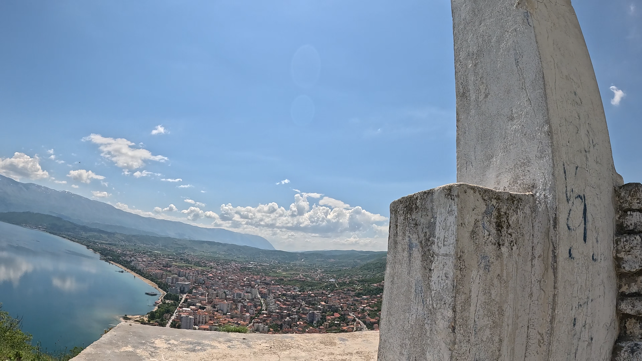
It is a view that puts the whole region in context. From here you understand, in a single glance, why people have wanted to hold this hilltop for thousands of years.
The history of the Castle of Pogradec
The hill you have just climbed has been occupied for around two and a half thousand years. The Castle of Pogradec (in Albanian, Kalaja e Pogradecit) was built on an Illyrian settlement dating to the 5th century BC, and by the 4th century BC it had been fortified with defensive walls. Some scholars connect the site with the ancient Illyrian tribe of the Enchelei, with the surrounding region also associated with the Dassaretae.
The settlement thrived for centuries, but in the second half of the 2nd century BC, during the wars between the Illyrians, the Romans and the Macedonians, it was destroyed by a major fire, possibly during the fighting itself. The hilltop later passed through the hands of the great powers that controlled this corridor of the Balkans in turn: the Roman Empire and then the Byzantine Empire, under whom the fortress was strengthened as part of Emperor Justinian I's wide programme of fortification in the 6th century AD.
The castle was inhabited until around the 10th century, after which its residents gradually moved down the hill to settle closer to the lake, where the modern town of Pogradec eventually grew. In the medieval centuries that followed, the area fell under a succession of local and regional powers, including the Principality of Arbanon, the Principality of Gropa and the League of Lezhë, before passing under Ottoman control.
Today the castle is a ruin, but a significant one. Parts of the western walls remain partially intact, and although much of the site is now buried or reduced to rubble, archaeological finds of pottery and wall remnants have confirmed its deep Illyrian and Byzantine roots. In 1963 the Albanian government designated it a Cultural Monument of the First Category. More recently, a restoration project has been announced, backed by European Union funding, with plans for archaeological excavation, a panoramic balcony and an on-site archaeological museum, alongside improvements to the access road. For now, what draws people up the hill is the same thing that drew the Illyrians: the commanding position and the extraordinary view.
Start early on hot days, as much of the climb is exposed and the incline is the hardest part of the walk. Carry plenty of water, wear comfortable footwear suitable for a dirt road, and bring sun protection. Because the route is unmarked above the edge of town, it is worth downloading an offline map before you set out. The castle itself is an unguarded ruin, so watch your footing around the old walls and uneven ground.
Know before you go: Pogradec Castle FAQ
How long is the hike to Pogradec Castle?
Starting from the centre of Pogradec, the round trip is roughly 4 miles (about 6.4 km), with the exact distance depending on where you begin. It makes for a comfortable half-day outing.
How hard is the climb?
It is a moderate hike. There is no scrambling or technical terrain, but the steady incline can feel challenging on a hot day. Take your time, start early and bring water and the climb is manageable for most reasonably fit walkers.
Is the trail marked?
Only partly. A single sign on the edge of town points toward the start, but above that the route is unmarked. Follow Kajo Karafili or Dëshmorët e Pojskës to Unaza, then work through the hillside neighborhood to Rruga e Kalasë (Castle Street), the dirt road that leads all the way up.
What can you see from the top?
Panoramic views of Pogradec, Lake Ohrid and the surrounding mountains. On a clear day you can see the villages of Lin, Udenisht, Memëlisht and Tushemisht, as well as the city of Ohrid and other towns across the lake in North Macedonia.
How old is the Castle of Pogradec?
The site was first settled by the Illyrians in the 5th century BC and fortified in the 4th century BC, giving it roughly 2,500 years of history. It was later held by Roman, Byzantine and Ottoman powers and was named a Cultural Monument of the First Category in 1963.
Disclaimer
The route description, directions, distances and conditions in this post reflect our own experience and are not guaranteed to match what you will find. Streets, signage and trail conditions change. The castle is an unguarded ruin on uneven ground. The author and the owner of this website accept no responsibility or liability for any accident, injury, loss, or death arising from use of this information. You hike entirely at your own risk. Carry water, wear suitable footwear, check conditions locally, and tell someone your plans. In an emergency, dial 112.