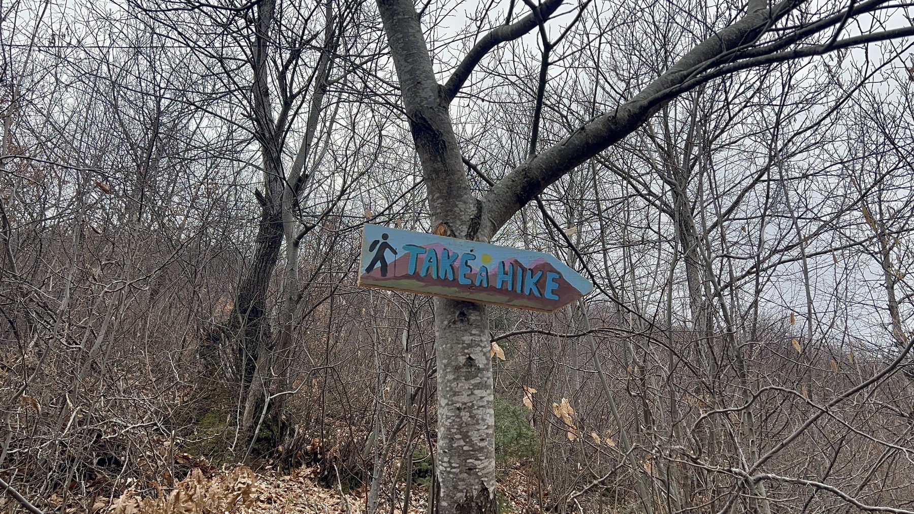
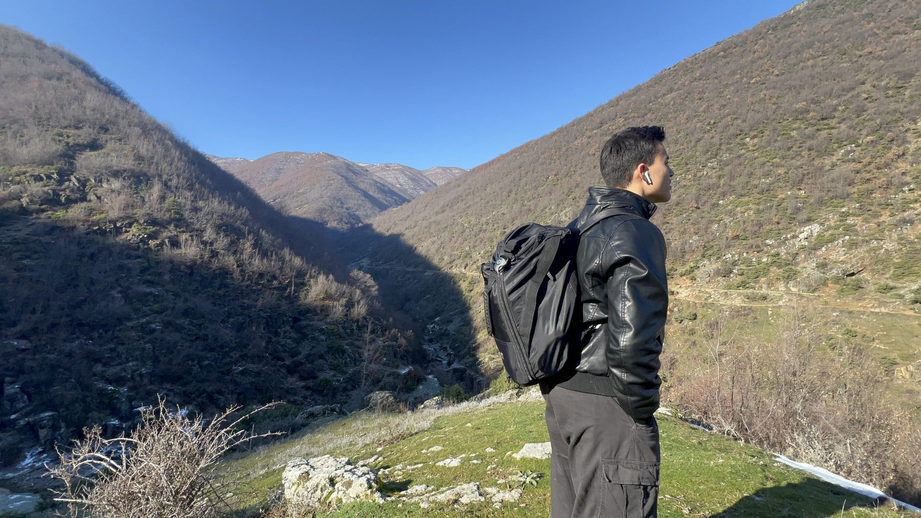
We hiked the Kabash Trail last summer on a hot, bright day and it has stuck with us as one of the best walks we've done anywhere around Pogradec. It's a well-loved route that hikers here have followed for years, long before we arrived, and these days you'll regularly see hiker groups and tour companies sharing their own Kabash hikes on social media. Walk it once and it's easy to see why.
The Kabash Trail has a little of everything. Part of it is open to the sun with sweeping views; part of it is closed in by woodland, roughly three-quarters of the route is shaded, which is a real reprieve from the glare on a hot day. It runs as a long U-shape of about 5 miles (8.05 km) with around 1,800 ft (549 m) of elevation gain. Add an old hilltop church, a string of waterfalls and some curious rock formations along the way, and you have a full, rewarding day in the mountains above Lake Ohrid.
This is our complete guide to the trail, the route leg by leg, where it starts, what to watch out for, and everything we wish we'd known before we set off.
We've hiked the Kabash Trail more than once. The photos in this guide come from two different visits at different times of the year, so you'll see the trail in more than one season as you scroll.
The Kabash Trail at a glance
The Kabash Trail runs as a long U-shaped loop. Distance, elevation and timing will vary depending on which trailhead you start from, which side trails you follow, and conditions on the day.
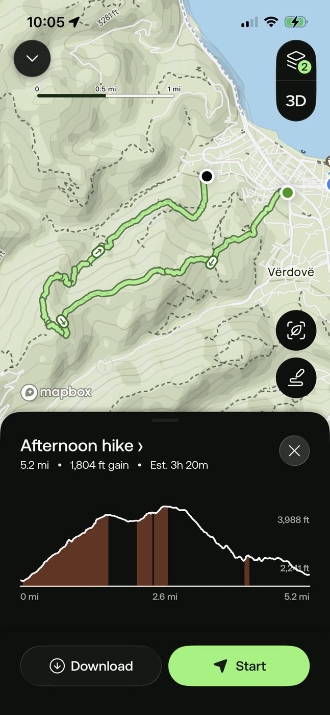
Start early on hot days; the first leg is fully exposed. Carry plenty of water and electrolytes, wear proper footwear, and download an offline map (we use AllTrails) before you set off, as phone signal drops out on parts of the mountain. Pack a basic first aid kit, and check the forecast: the last leg can get muddy after rain.
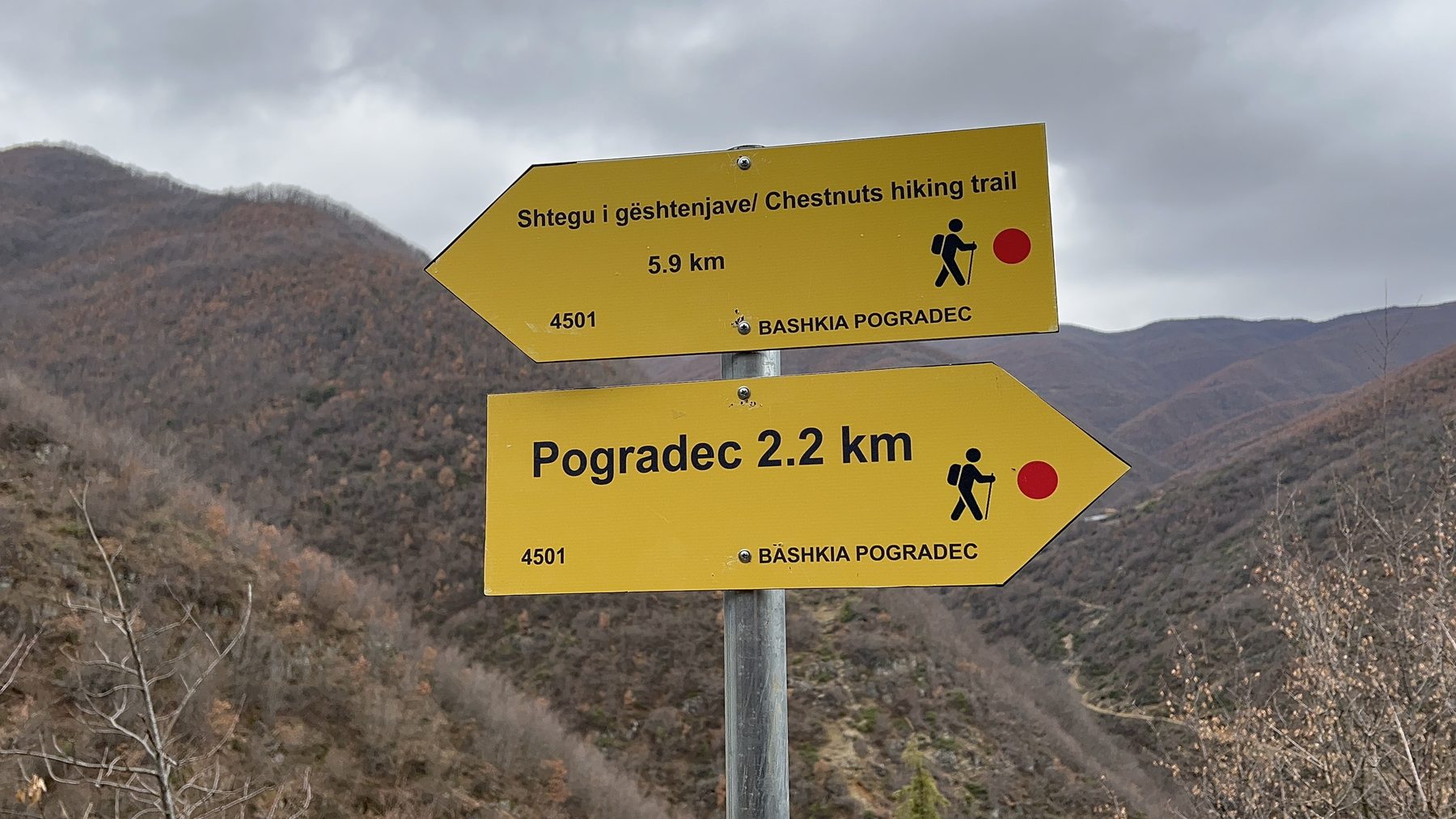
Where the Kabash Trail starts
The official trailhead is at the end of Rruga Justinian, in the hills behind Pogradec. Because the trail is a long U, you can also begin from the other end — at the end of Rruga Gorices — and walk the loop in reverse.
We started from Rruga Justinian and finished on Rruga Gorices, so that's the direction this guide follows. Whichever end you choose, the two trailheads sit a short distance apart in town, which makes the logistics easy: a quick walk or taxi links the start and the finish.
Here is the AllTrails 3D replay of our recorded hike, so you can see the full route and the shape of the loop:
Leg One: the climb
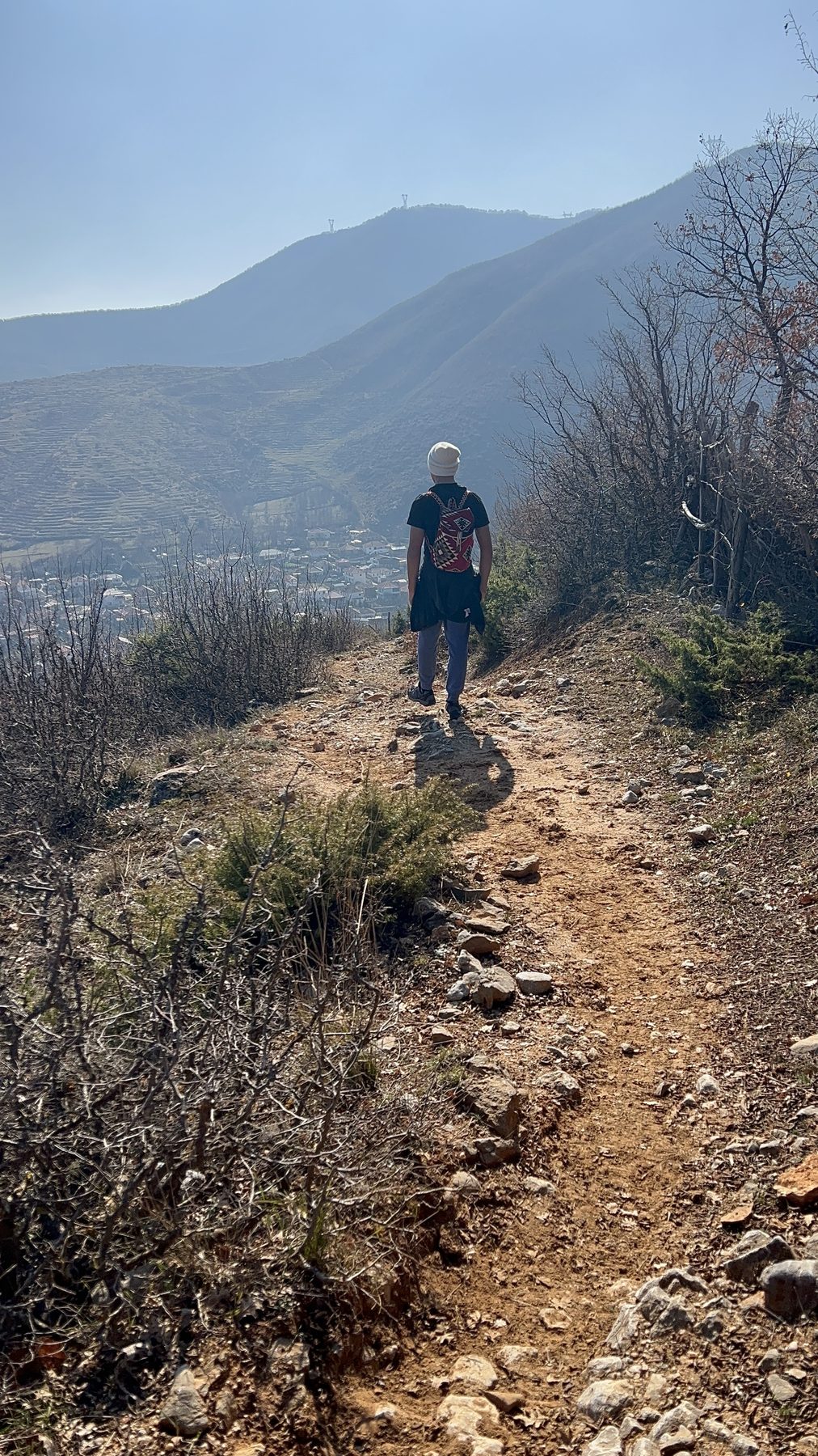
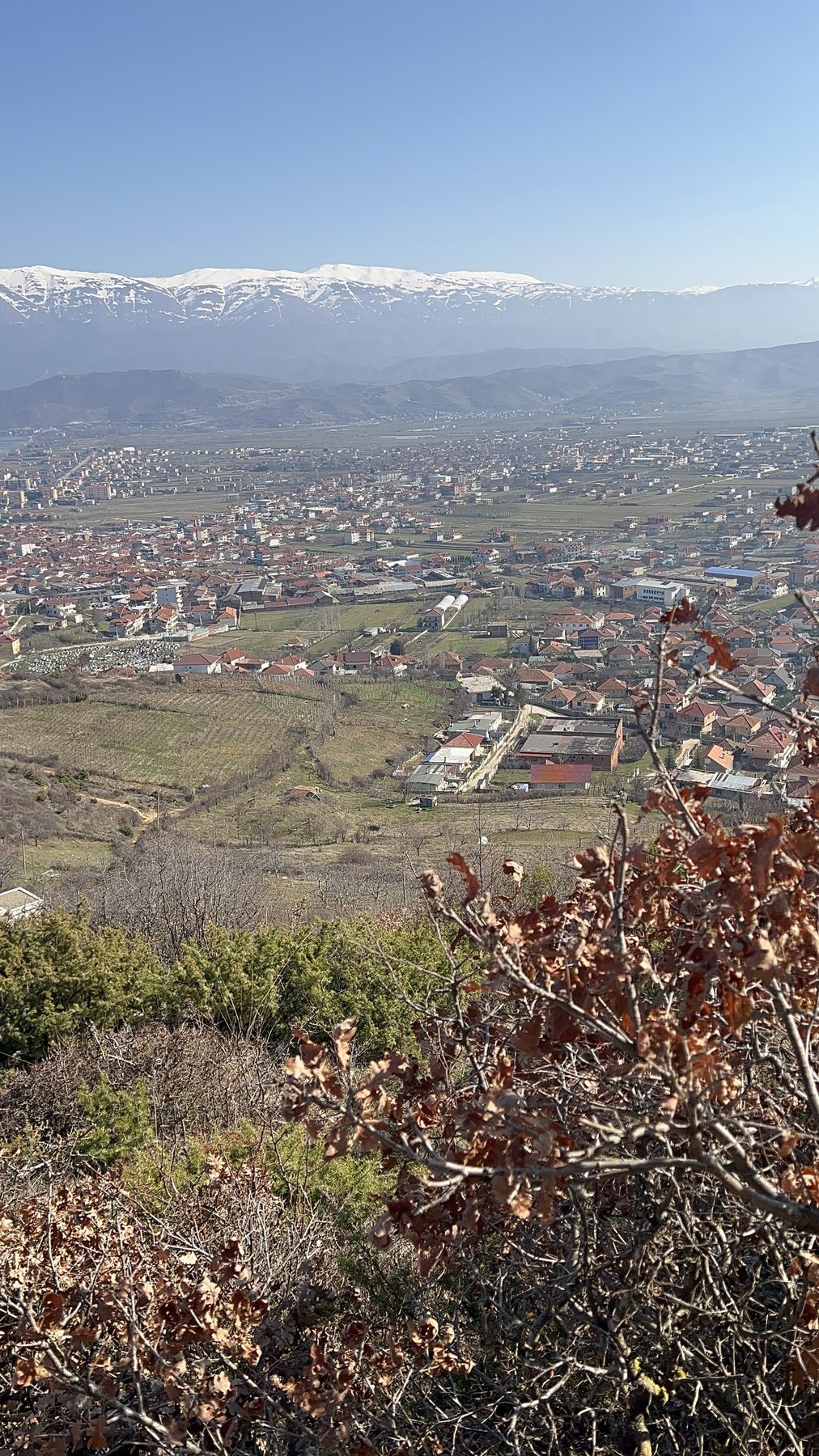
The first leg (starting from Rruga Justinian) is the most demanding part of the whole trail. It opens with a steady, significant incline, and this is where you'll do most of the harder hiking of the day.
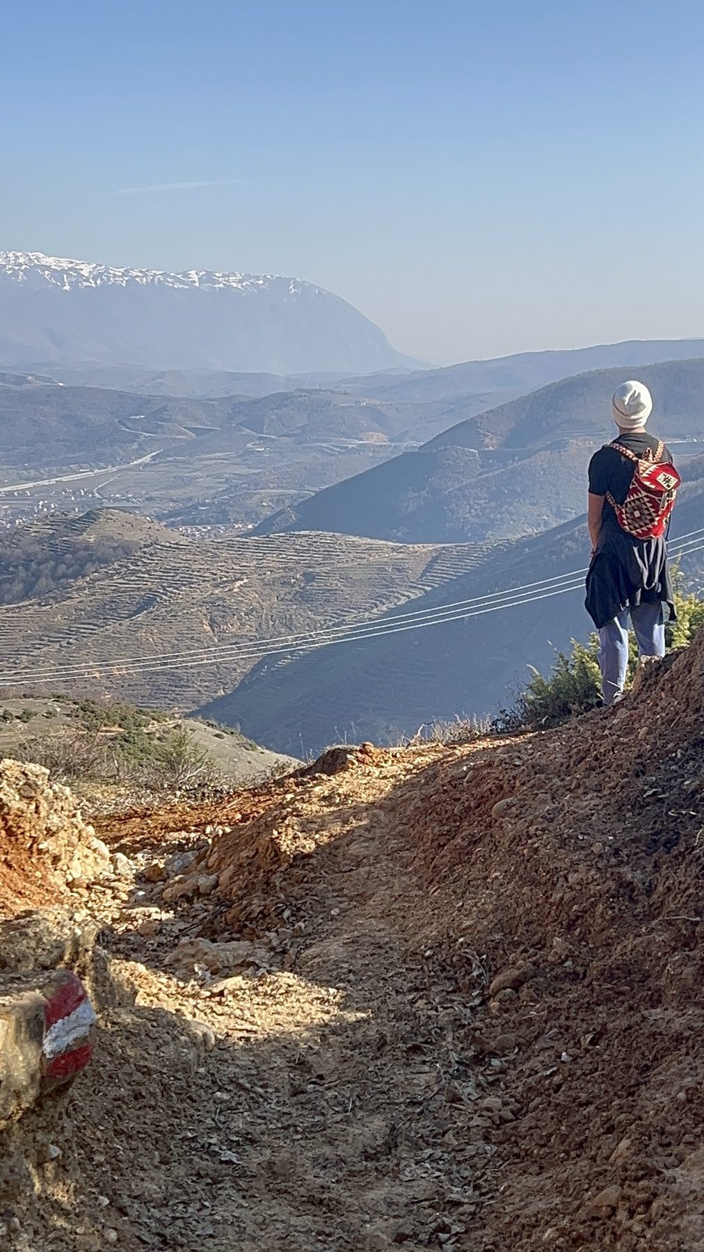
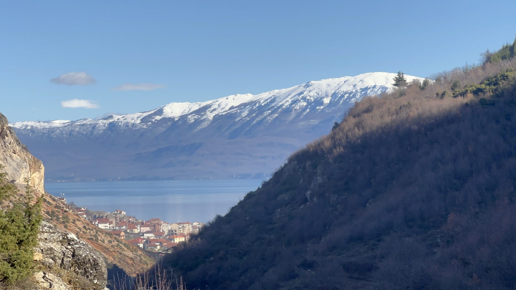
This section is wide open to the sky. There's little shade, so on a hot day you'll want an early start and plenty of water, but the trade-off is the view. With every step uphill the panorama improves: Lake Ohrid spreading out below you, the town of Pogradec, and the scatter of surrounding villages. On a clear day, no fog, no rain, you can see all the way across to North Macedonia.
The climbing trail doesn't push to a summit. Instead it wraps around the shoulder of the mountain, and as you round it the view quietly changes: the lake slips out of sight and a new landscape of layered, rolling mountains opens up behind Pogradec.
Into the forest
Then you reach the woods and it's welcoming shade. The trail eases here too: it flattens out and becomes a much gentler walk.
By our rough estimate you climb around 1,000 ft (305 m) before the trail levels off, though this depends on exactly where you started and which paths you took along the way. From this point on, roughly three-quarters of the route is sheltered by trees.
The Guri i Kamjes viewpoint
As you get closer to the bend of the "U", the trees open up and reward you with a wide view across the surrounding mountains. Look into the distance and you may spot a distinctive plateau-shaped rock formation jutting out of the landscape. That is Guri i Kamjes (an incredible hike in its own right, and one we highly recommend, see the blog & video!) You'll also find it on our hiking trails page. And good news if you're short on time or energy: you can drive to Guri i Kamjes as well.
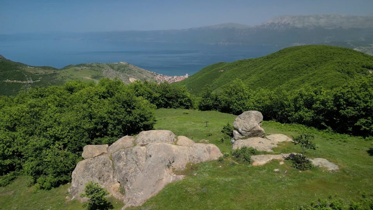
The summit clearing & the sheep
Soon after that viewpoint the trail climbs again and curves to the right (assuming you're walking the direction we did). Then it delivers you into a clearing at the top of the mountain — open ground with spectacular views falling away on both sides.
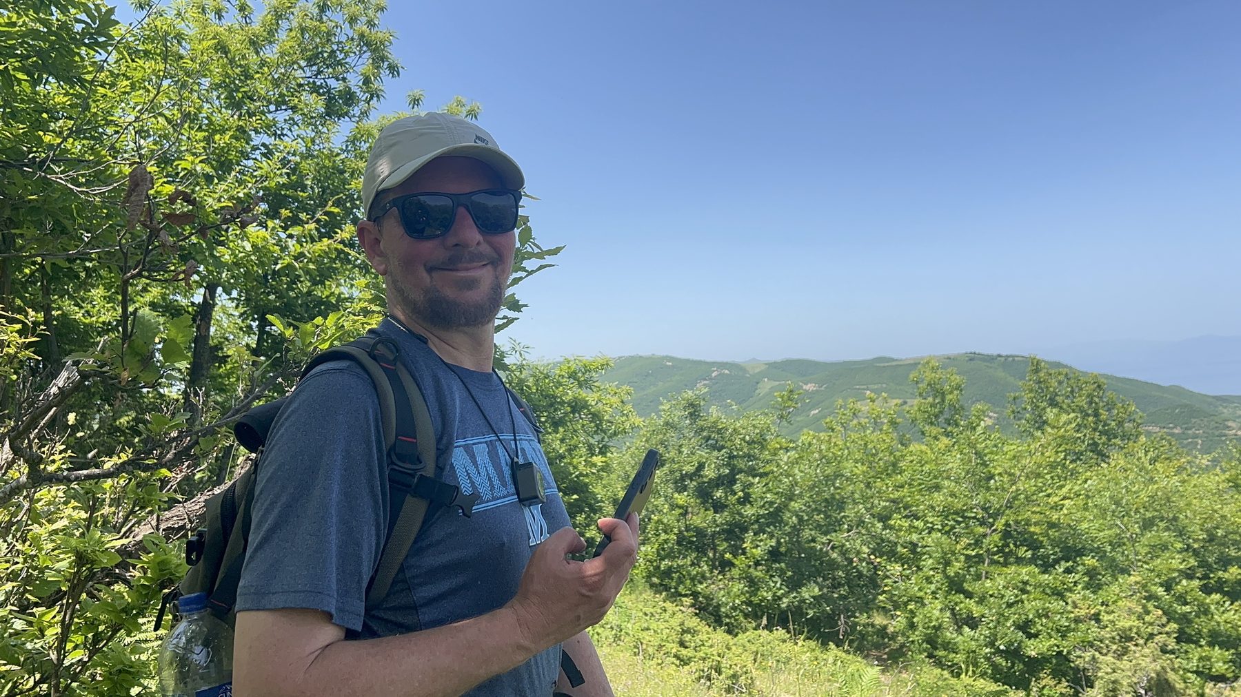
This is where we met a flock of sheep, with the herders nearby taking a leisurely nap in the shade. It's an excellent place to stop: rest, recharge, and have some snacks and electrolytes before carrying on. We also captured some of our best drone footage of the whole hike from up here.
Don't approach the sheep. The flock is guarded by working dogs, and they will chase you off...I found out. I got a little too close trying to take a photo. Give any herd and its dogs a wide berth, move slowly and calmly, don't run, and let the herders manage their dogs if they are nearby.
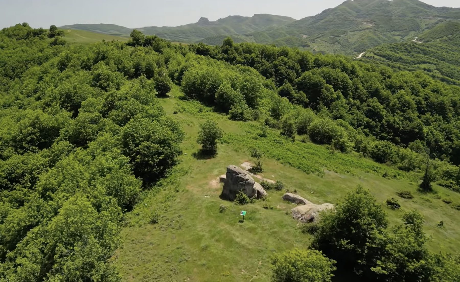
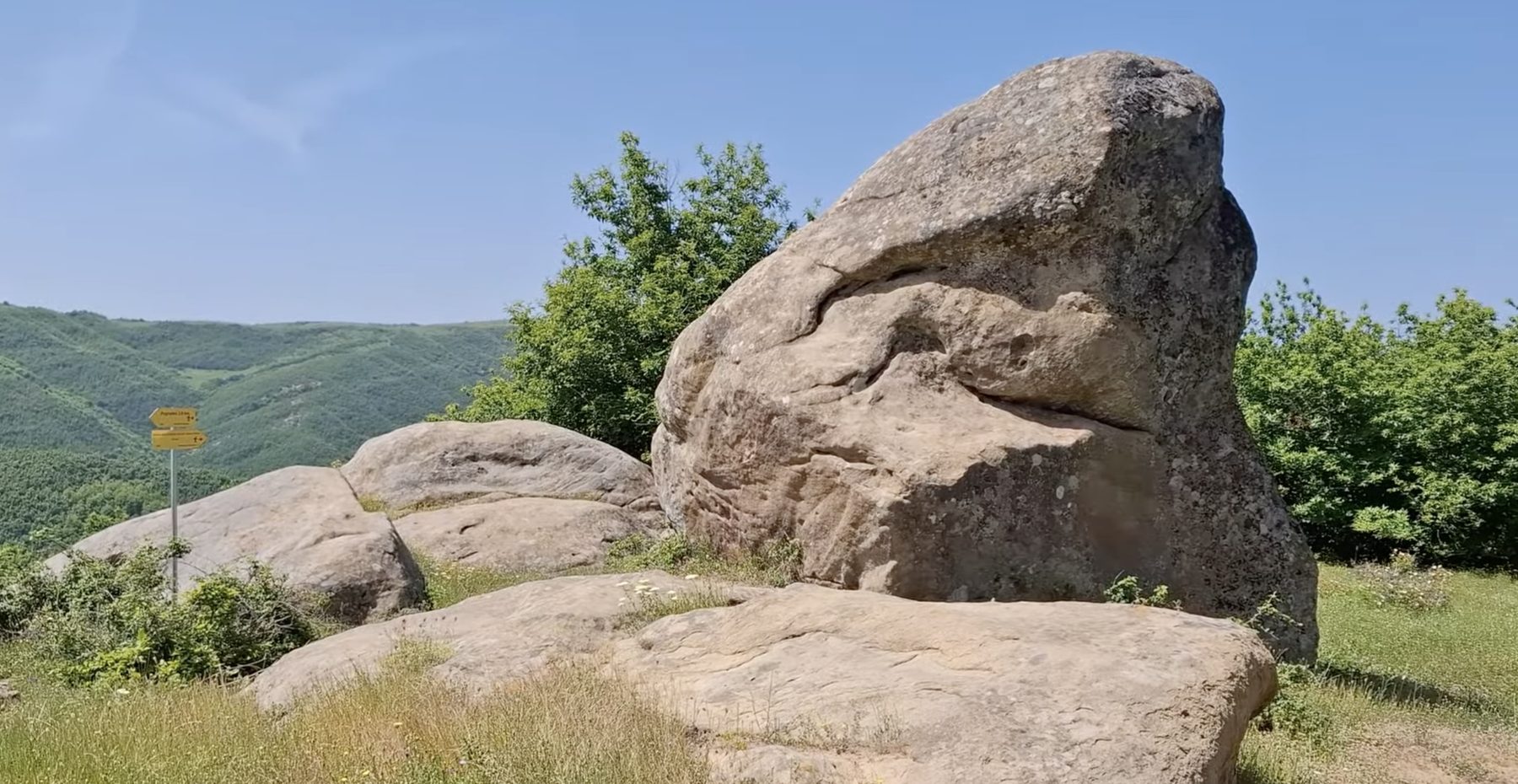
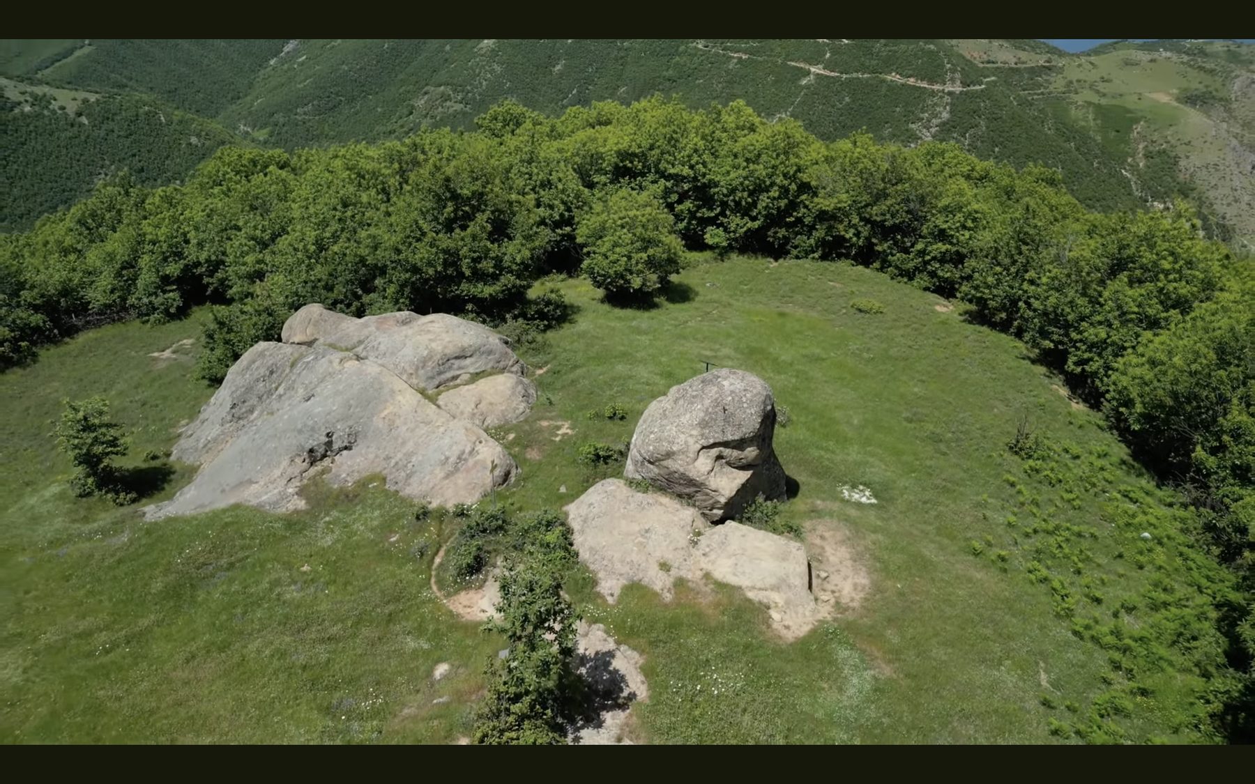
Rock formations & the Stone of Hol Brana
Past the clearing, the trail leads you through some intriguing rock formations. One of them is a large rock known as the Stone of Hol Brana, marked with a placard that recounts the believed history of the stone and the local stories attached to it; worth pausing to read.
This is also where the trail begins to descend, and where it can get faint. The Kabash Trail is crossed by a web of sheep- and goat-herders' paths, and many of those don't appear on the AllTrails map we were using. We lost our AllTrails signal around here and briefly got off-route. Fortunately, the shape of the mountains kept us oriented and we found our way back to the main trail. It's a good reminder to download an offline map before you set out and to keep a general sense of your bearings.
Leg Two: the return to Pogradec
Now you're on the second leg of the U, heading back toward Pogradec and Lake Ohrid.
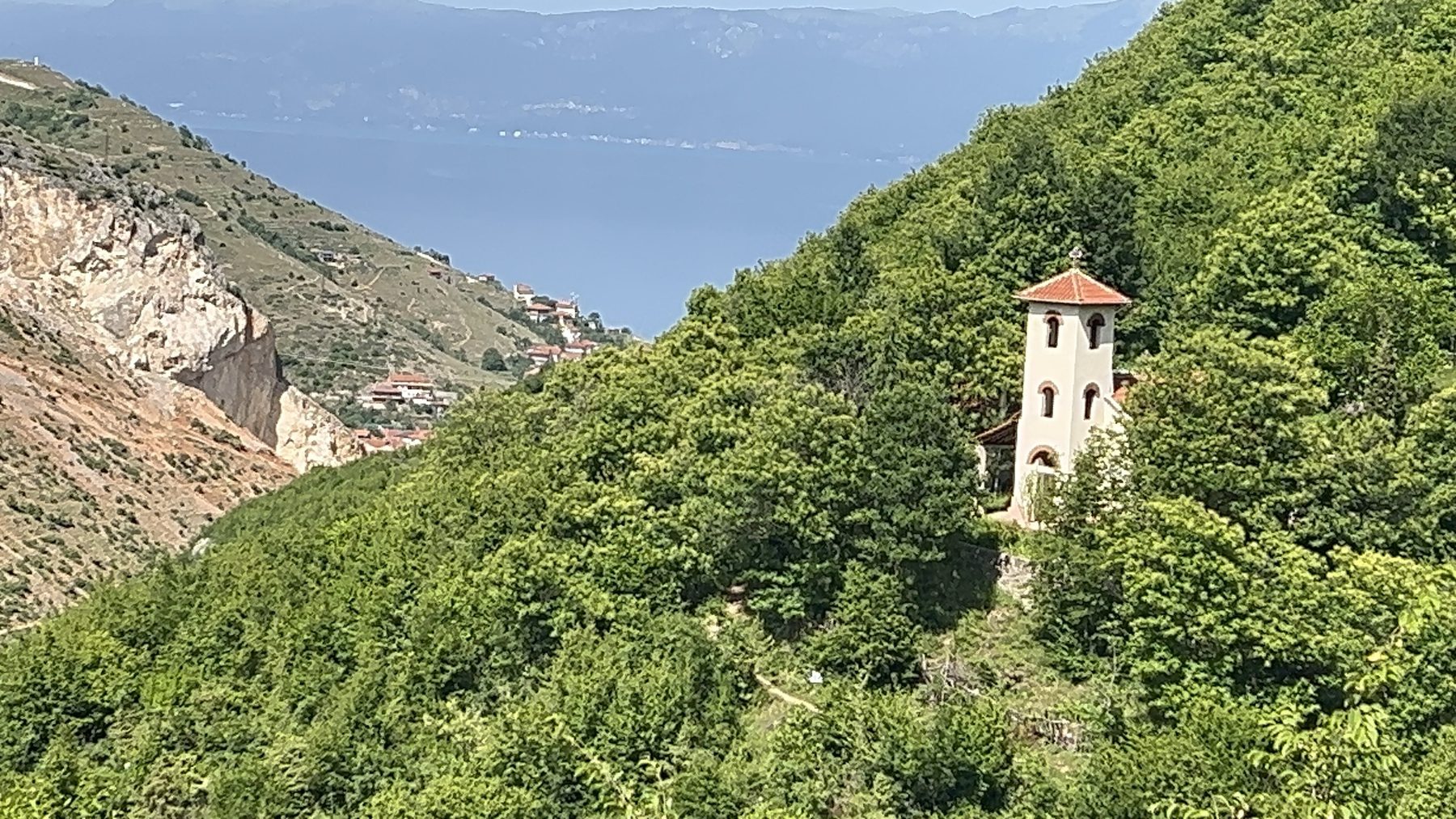
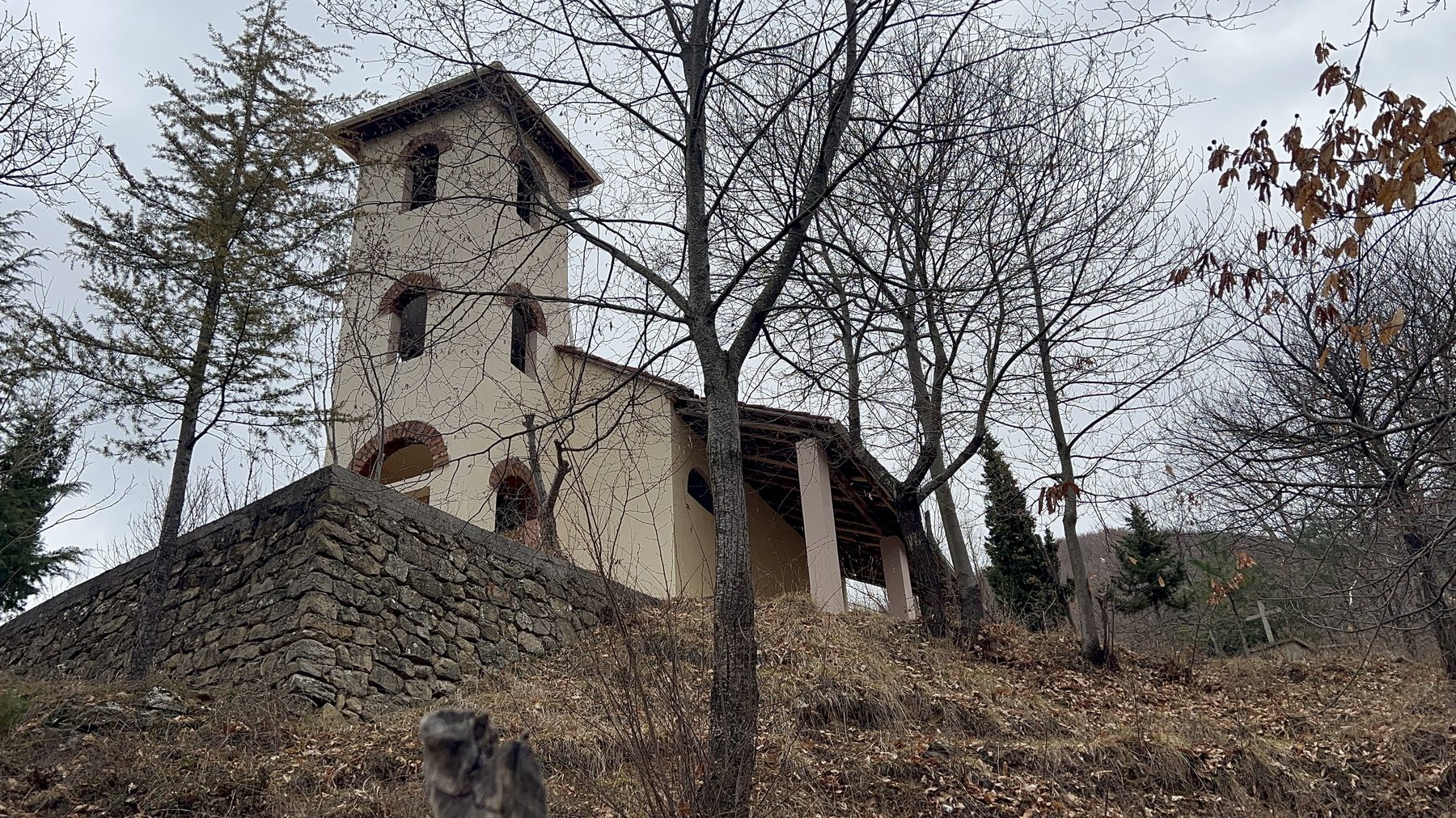
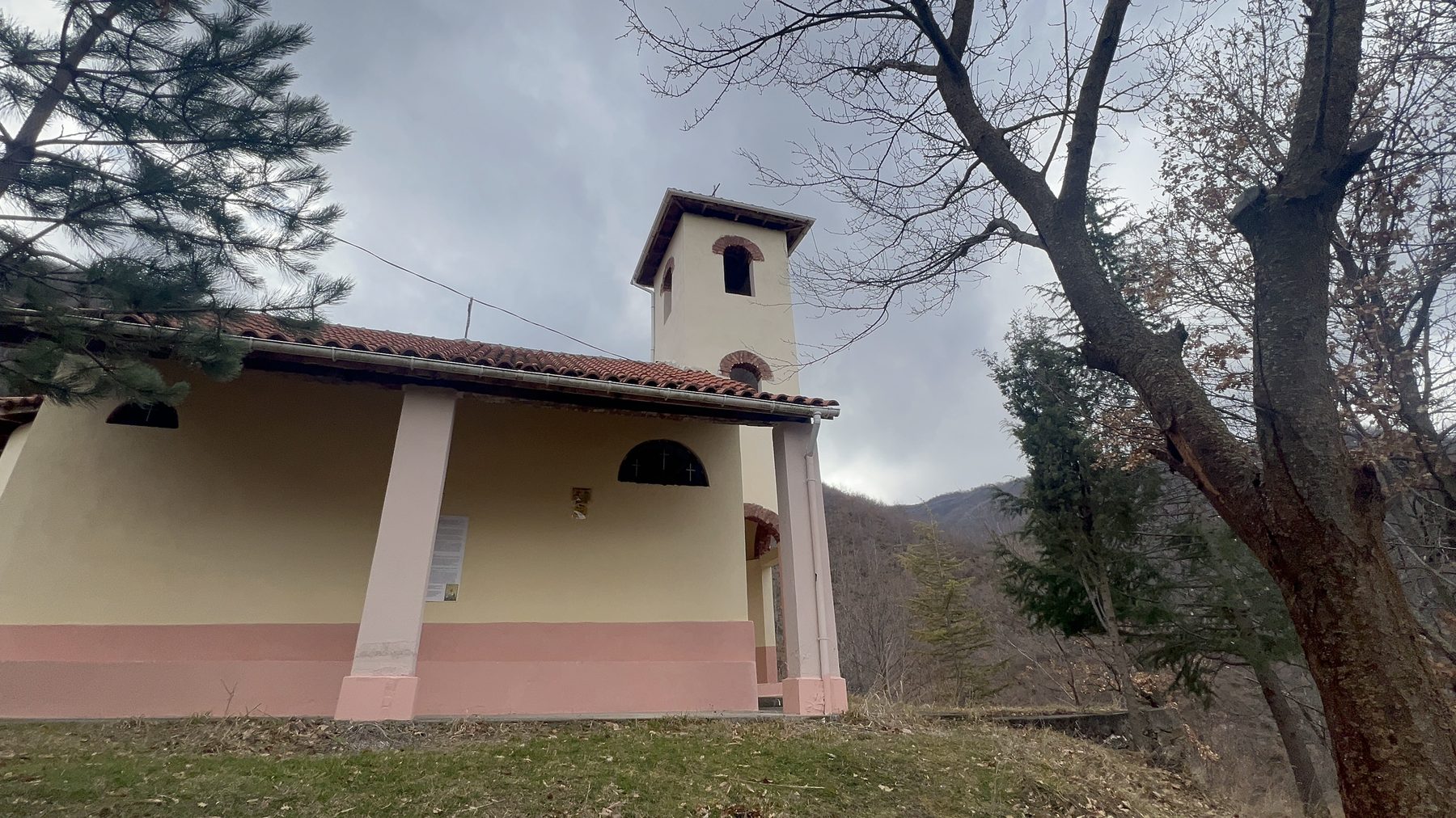
Along this stretch you'll come to Kisha Shën e Diela (St. Sunday Church) the old church of Kabash. It sits on a natural balcony of the mountainside, and it's one of the trail's quiet highlights: the spot looks out over the city, the broad sweep of the lake and the green folds of the surrounding hills. The church itself is old — not ancient, but clearly long-standing; and its peaceful, out-of-the-way setting makes it a lovely place to pause.
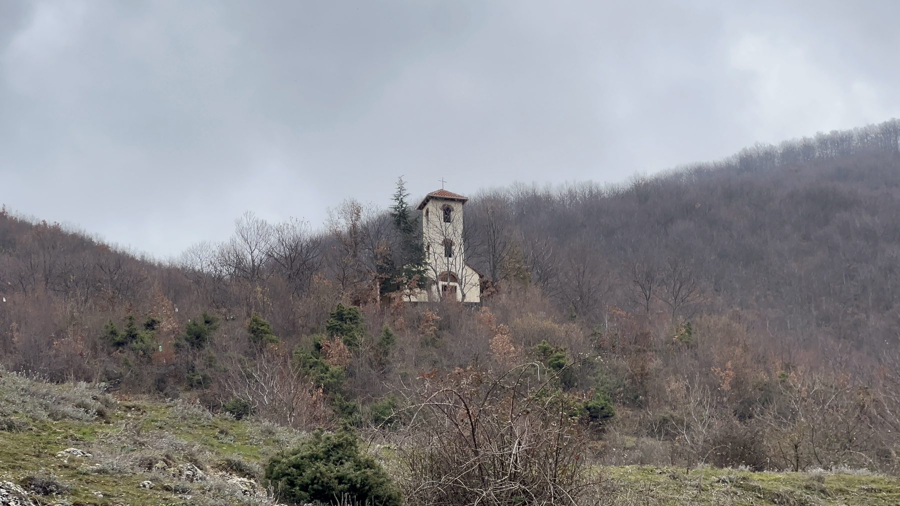
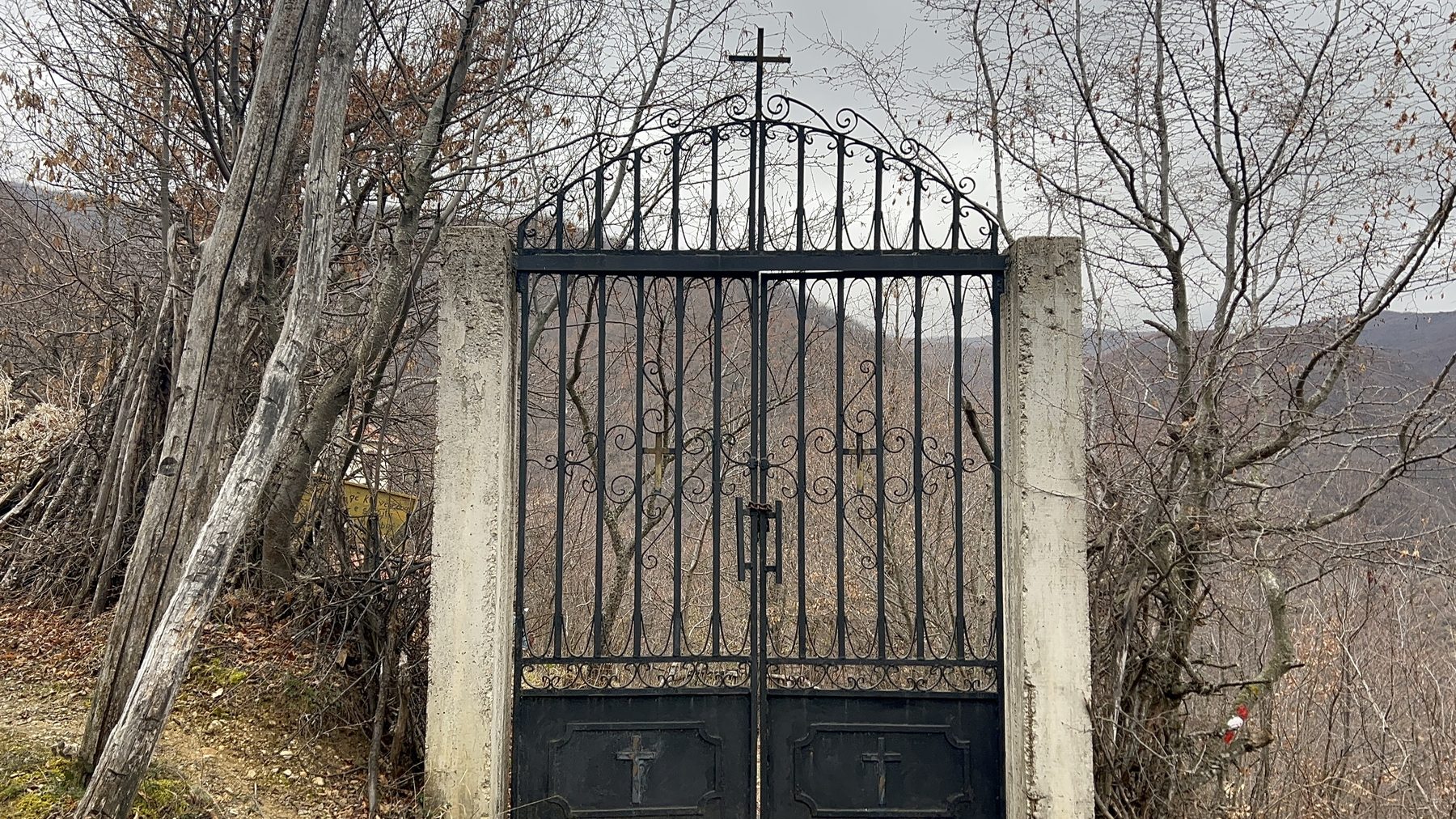
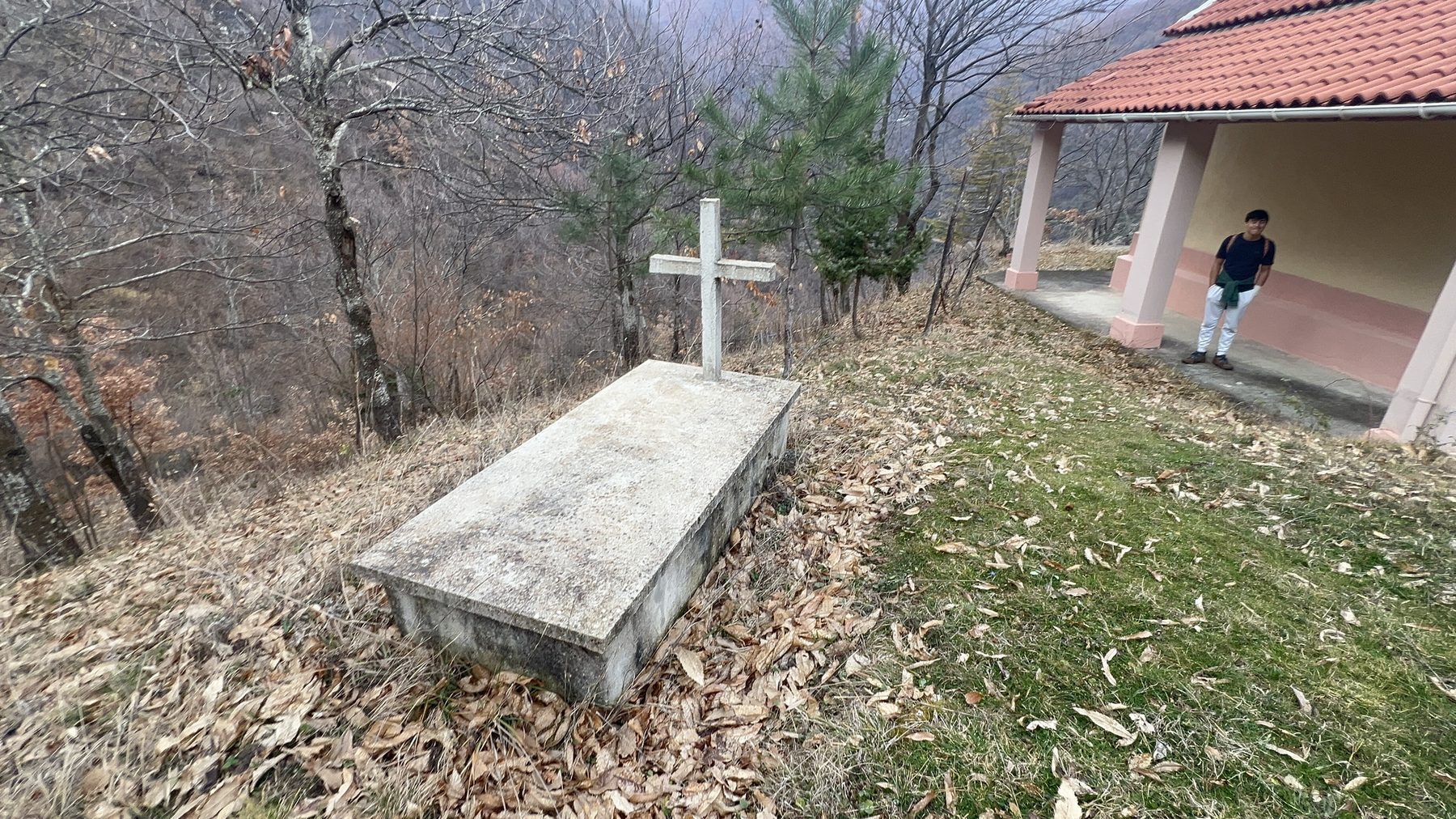
It's worth taking a few minutes to wander the grounds. Through the old gate, past an unnamed grave, with the views opening up on every side.
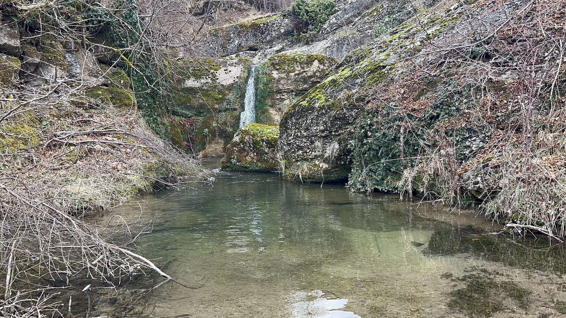
Side quest: the Kabash waterfalls
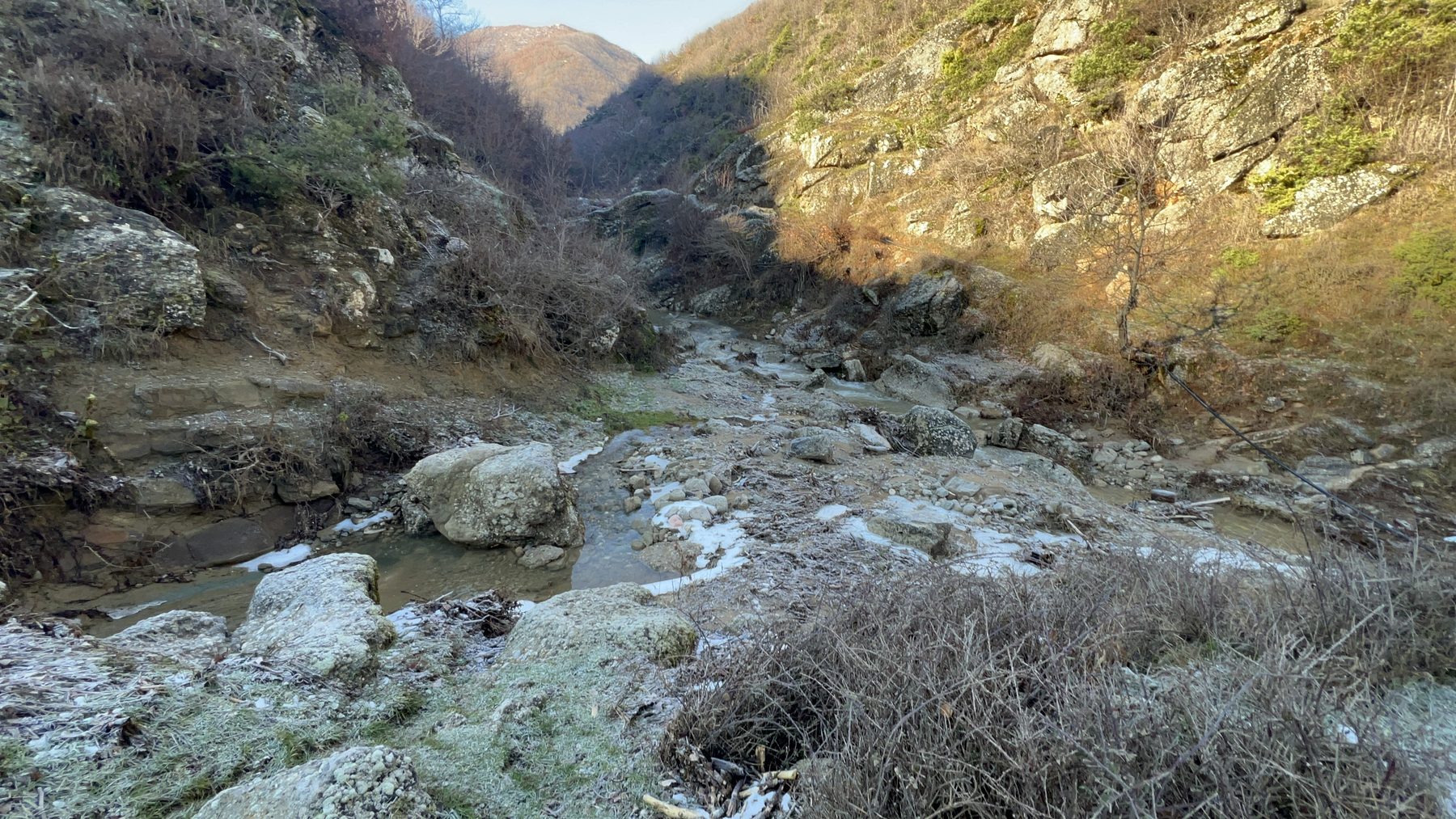
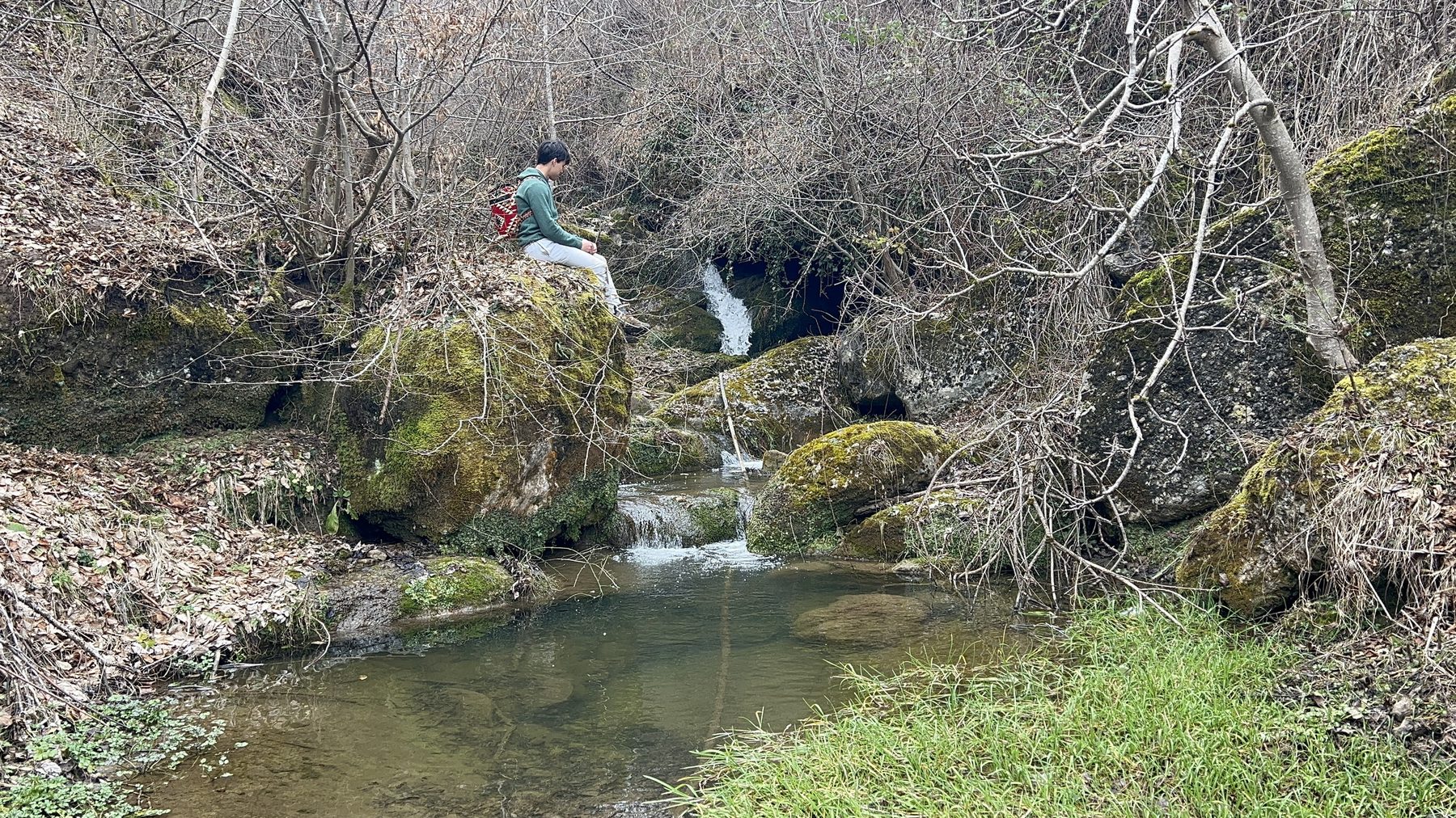
From the church, you can take a worthwhile detour to the Kabash waterfalls: listed as "Ujëvara e Kabashit" on Google Maps. As you walk, you may hear the stream running down the ravine a little to the north-west of the trail.

Be warned: reaching the water means a significant, steep descent down to the stream and you'll have to climb back up the same way on your return. About halfway down, the trail reaches a natural plateau, a flat shelf of ground that makes an ideal place to stop, rest and catch your breath. It also opens up some of the very best views of the entire hike, so don't rush past it; it's well worth pausing here before continuing down to the water.
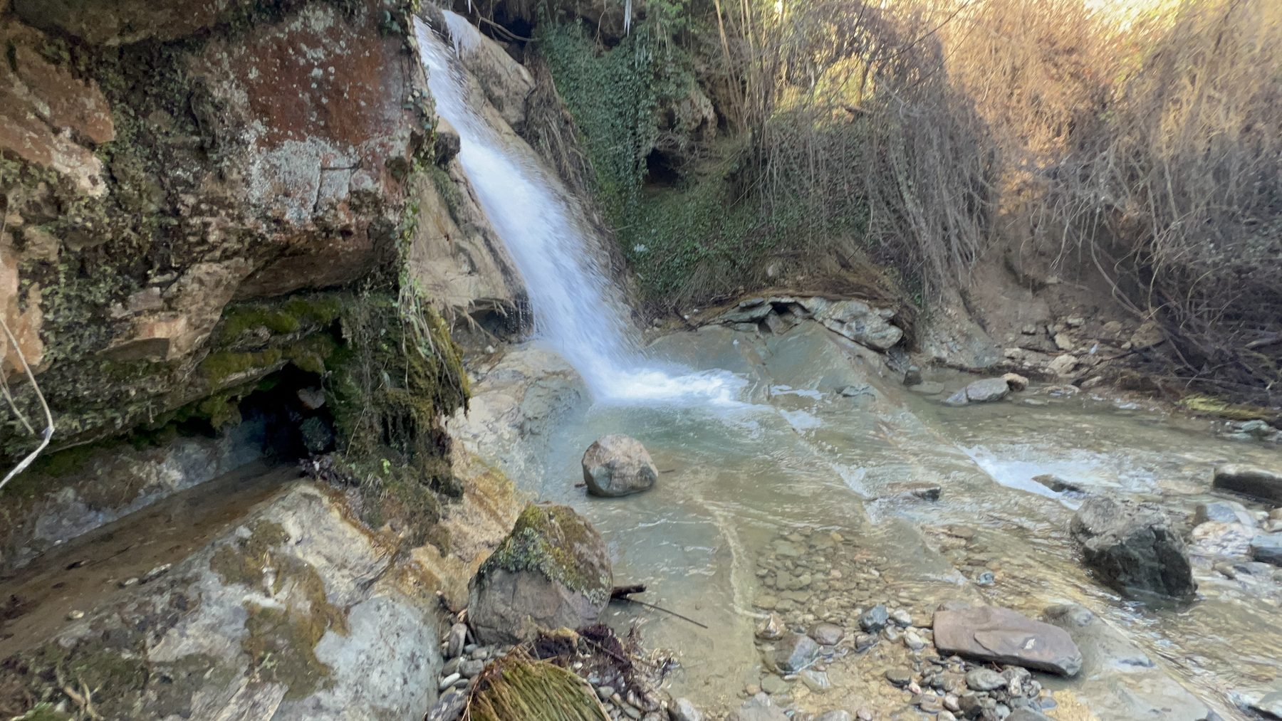
Once you reach the stream, follow it up into the mountains and you'll pass several small, scenic waterfalls before reaching the larger one. It's a beautiful spot for photos and a good place to cool down before you rejoin the main trail.
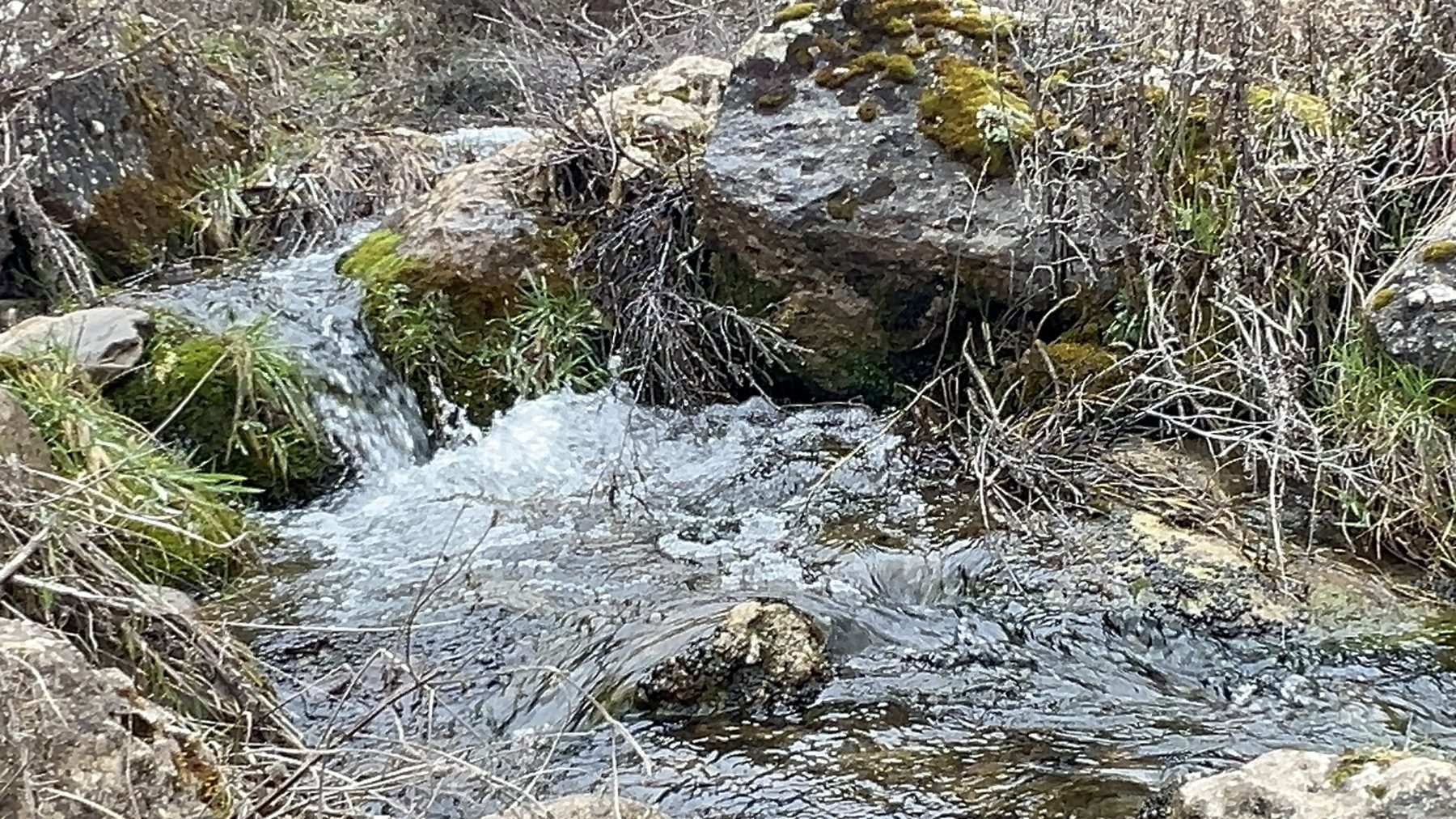
You'll pass a series of smaller falls along the way — each one a fine place to stop for photos.
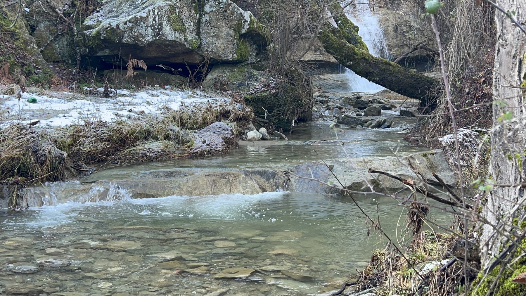
Keep going and you'll reach the largest waterfall, the high point of this side quest, and a wonderful place to cool off before you climb back up to the main trail.
The final descent
Back at Kisha Shën e Diela, pick up the trail again toward Pogradec. The majority of this final leg is relatively level, with only slight inclines and dips, until the very last section, where the path drops more steeply and delivers you out onto Rruga Gorices.
This final stretch can get muddy, particularly after recent rain. The last time we hiked it, part of the path had also started to erode away. It was still safe to pass with care at the time — but trail conditions change, so stay alert, take it slowly, and turn back if anything looks unsafe.
Is the Kabash Trail worth it?
For us, the Kabash Trail is probably our favourite hike in Pogradec. In a single loop you get scenic views of Lake Ohrid and the mountains, a string of waterfalls, an atmospheric old church and curious rock formations, a lot of variety for one day on your feet.
It's a moderate hike. The first-leg climb asks something of you, but nothing extreme, and the long shaded middle section is genuinely relaxing. Bring plenty of water and a first aid kit, watch your footing on the muddy and eroding sections, give the herd dogs their space, and you're in for one of the best days out that Pogradec has to offer.
Know before you go: Kabash Trail FAQ
How long is the Kabash Trail?
The Kabash Trail is about 5 miles (8.05 km) long, walked as a U-shaped loop, with roughly 1,800 ft (549 m) of elevation gain.
How hard is the Kabash Trail?
It's a moderate hike. The toughest part is the steady climb on the first leg; after that the trail flattens out and is mostly shaded. Most reasonably fit hikers will manage it comfortably, taking breaks along the way.
Where does the Kabash Trail start?
The official trailhead is at the end of Rruga Justinian, in the hills behind Pogradec. You can also start from the end of Rruga Gorices and walk the loop in reverse.
Is the Kabash Trail shaded?
Roughly three-quarters of the trail is shaded by woodland. The exposed first-leg climb is the main sunny stretch, so an early start and sun protection help a lot on hot days.
Can you visit the Kabash waterfalls from the trail?
Yes. A side trail near Kisha Shën e Diela church leads to the Kabash waterfalls (Ujëvara e Kabashit). Expect a steep descent down to the stream and a climb back up — and a series of small falls before you reach the largest.
Are there dogs on the Kabash Trail?
You may meet livestock-guarding dogs working with sheep flocks on the mountain. They are not strays — they are protecting the flock. Keep well clear of the sheep, stay calm, don't run, and let the herders manage their dogs.
Disclaimer
The route description, distances, timings and trail conditions in this post reflect one hike on one day and are not guaranteed to match what you will find. Trails change — paths erode, become overgrown, or are rerouted, and weather can transform conditions quickly. Navigation on a trail crossed by unmarked herder paths involves real risk. The author and the owner of this website accept no responsibility or liability for any accident, injury, loss, or death arising from use of this information. You hike entirely at your own risk. Always check current conditions locally, carry water and a first aid kit, and tell someone your route and expected return time. In an emergency, dial 112.